
From Our Archives: NASA Climate Change: The Harvest
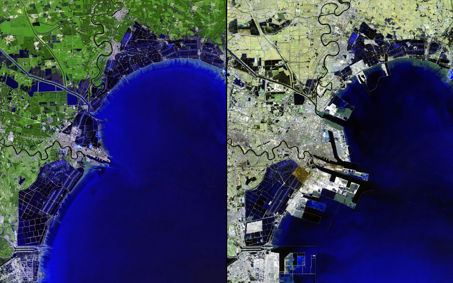
Left: Before, Right: After. Urban Growth, China. July 1992 – April 2012. Courtesy of USGS/NASA Landsat.
This interview was originally featured in ISSUE NO. 14: SCIENCE & TECHNOLOGY
Isabelle Hay: Some photos on the Images of Change website are older than the Internet. What was behind the curation of these images onto a web platform?
Laura Tenenbaum: Climate change is very visual. You can tell the story with words, but the story can also be told with pictures. Some of the images date back to the late 1800s, when women wore bustles and men wore top hats. In one of my favorite images, you can actually see a photographer and camera in the late 1800s in Alaska. I actually was the one who pulled those images together. They are from the National Snow and Ice Data Center, funded by NASA, out of the University of Colorado. The modern glaciologists found these very old images and would go to the same longitude and latitude at the same time of year, and take the exact same photo.
Isabelle: So with the more recent images, how did you all choose those locations? Were you aware of the changes that were taking place there prior to taking the image?
Laura: These satellites are flying 24/7, taking photographs 24/7. All three of us could spend our entire career just looking through the data record of NASA’s satellites, and we wouldn’t cover them all. It’s a matter of collating the images.
Holly Shaftel: We don’t look at these images with a trained eye, like some of the people who work with these science teams. I would even consider myself an untrained eye. So if there is a clear distinction between the two images then that’s worthy of putting on our site.
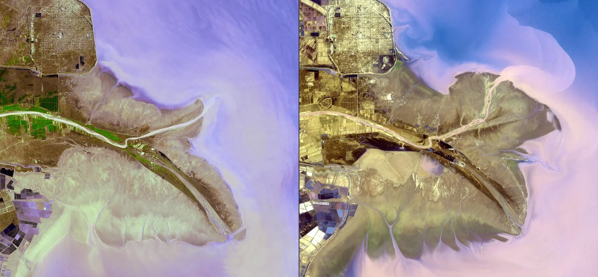
Left: Before, Right: After. River Changes, China. 2001 – 2009. Courtesy of NASA/GSFC/METI/ERSDAC/JAROS and the U.S./Japan ASTER Science Team.
Isabelle: How are the images rendered from the satellites?
Laura: The different satellites have different instrumentation on them. Some have scatterometers, some have altimeters. If you have an altimeter you’re only going to get altimetry data, you’re not going to get a photo. So a lot of the images you see are taken by the Landsat Satellite – I think we’re on Landsat 9. Holly and I go to the Landsat website and harvest the actual photographic images there. We then make them user friendly for the public. So we have to Photoshop them – but I don’t want to say they’re Photoshopped because that sounds like we’re doctoring the photos.
Isabelle: That’s interesting though. What are you doing to them?
Laura: Well, they come out in a format that’s not very user friendly. So we have to cut and size them properly.
Holly: Then we’ll put them on the site and make a before and after image, as well as a video to go through our carousel on our homepage. A before and after video.
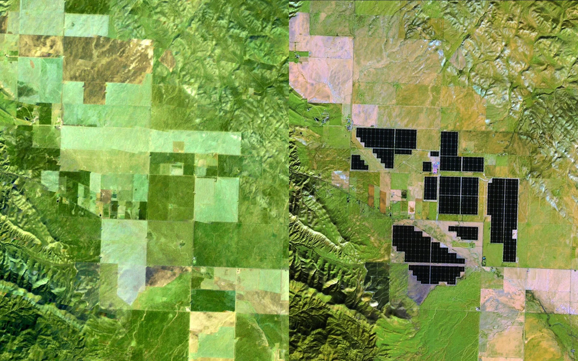
Left: Before, Right: After. Topaz Solar Farm, California. October 2011 – January 2015. Courtesy of USGS/NASA Landsat.
“This huge challenge is an opportunity to grow, and be what we could be as a society. ”
Isabelle: In regards to the Images of Change app, were you trying to encourage exposure of these images in the public eye? Were they reserved to scientists and geologists before this?
Laura: Absolutely not. It’s for everybody. There are people whose sole jobs is to make sure the academic community or the corporate community has access to information that they need. For example, oil rigs need to know sea level data.
Holly: Yes, they were originally intended for the general public. We magnify them on social media: on Facebook, Twitter, Instagram, and a little on Google Plus. We started doing this in showing the images, lately we’ve been moving to videos. We’re actually in the middle of a redesign for this gallery – to present the images ‘bigger and better.’ We want to make the web version of Images of Change, like the app, just as cool and user friendly.
Laura: NASA has four main mandates. One of the four is to engage the next generation of scientists. Part of the fabric of NASA is that every single thing that we do is in the public domain. All of this stuff would be out there even if Holly and I didn’t exist. We are like librarians with this enormous library. We come along and say look, this is what we believe the public is wanting. We listen closely and carefully to what the public is interested in. Believe me, the amount of satellites that we have, the amount of observations that they’re taking, if the average person was trying to find something, they’d get lost in a maze forever. Holly and I’s position is to make sure that the public has the best possible access in the best possible way to the NASA images and data.
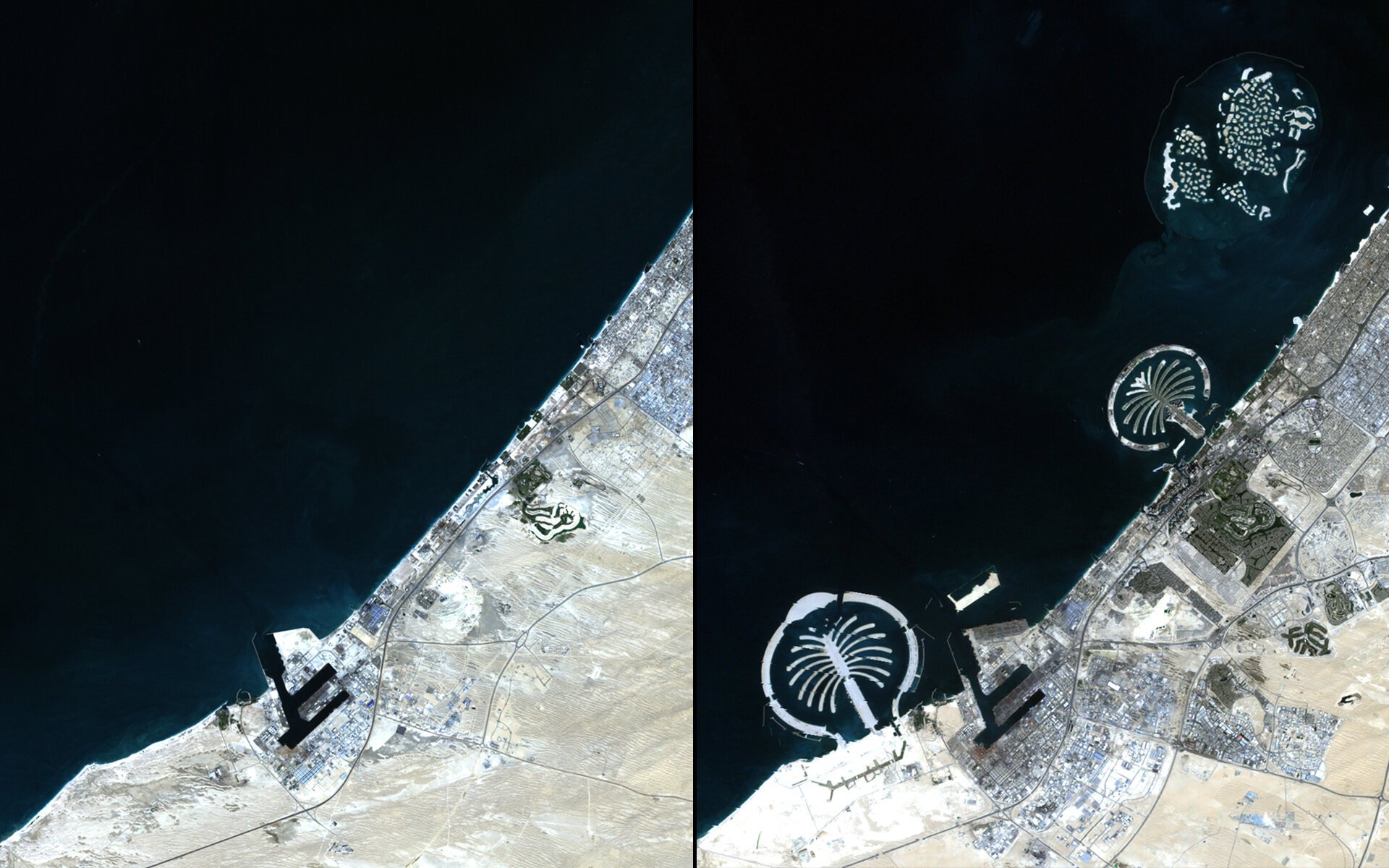
Left: Before, Right: After. Artificial Islands, United Arab Emirates. November 2001 – November 2012. Courtesy of USGS/NASA Landsat.
Read more of this interview in ISSUE NO. 14 - SCIENCE & TECHNOLOGY
Photo Editor: Nikhita Samala